The technology behind the journey
Our vehicles are rolling IoT platforms. Every kilometer is captured, analyzed and visualized - built from scratch, fully self-hosted, no cloud. On-board clients collect data on the go and send it home, where the server enriches the journey and a local AI evaluates completed drives.
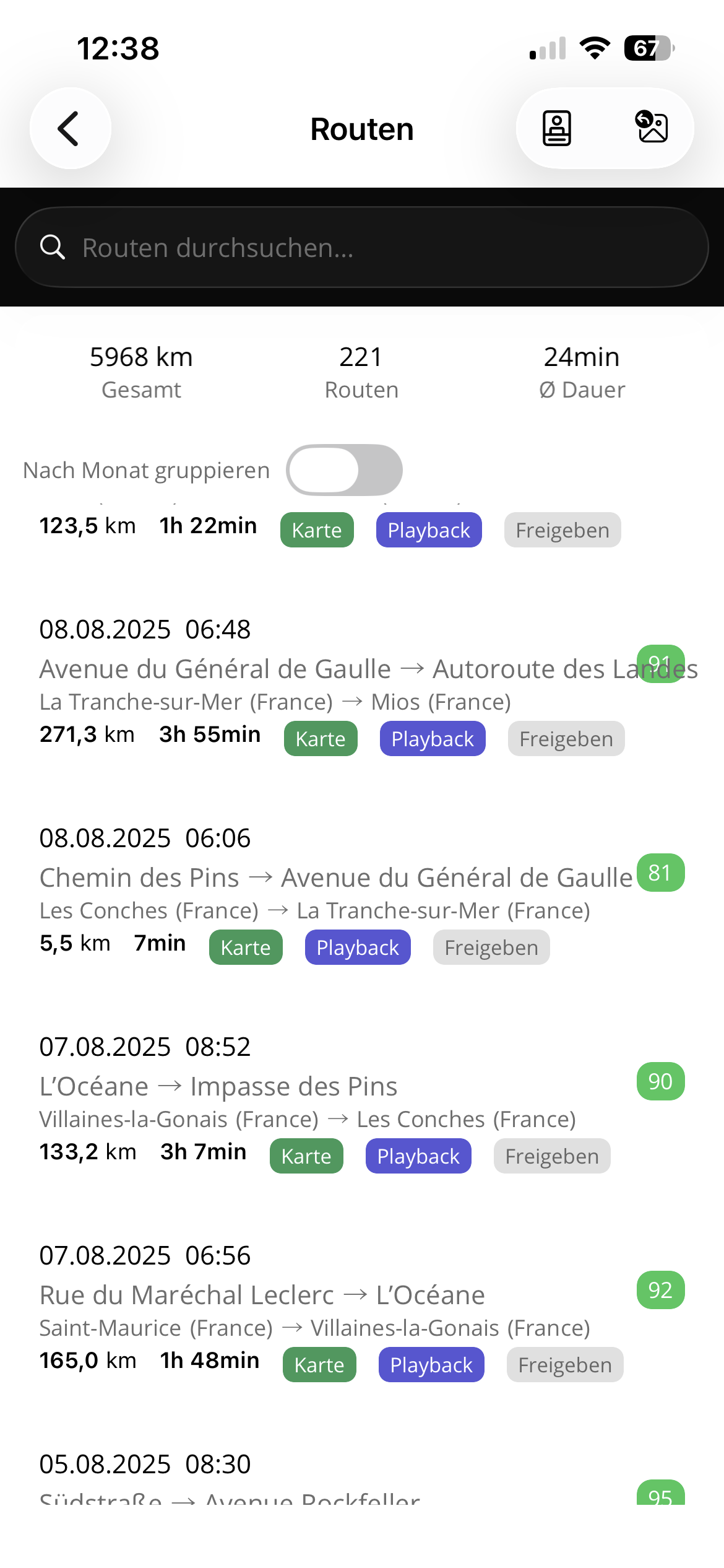
GPS & Route Analysis
High-frequency GPS tracking turns every drive into a structured route: road-matched, enriched with weather and locations, then replayable on the map with detailed analysis.
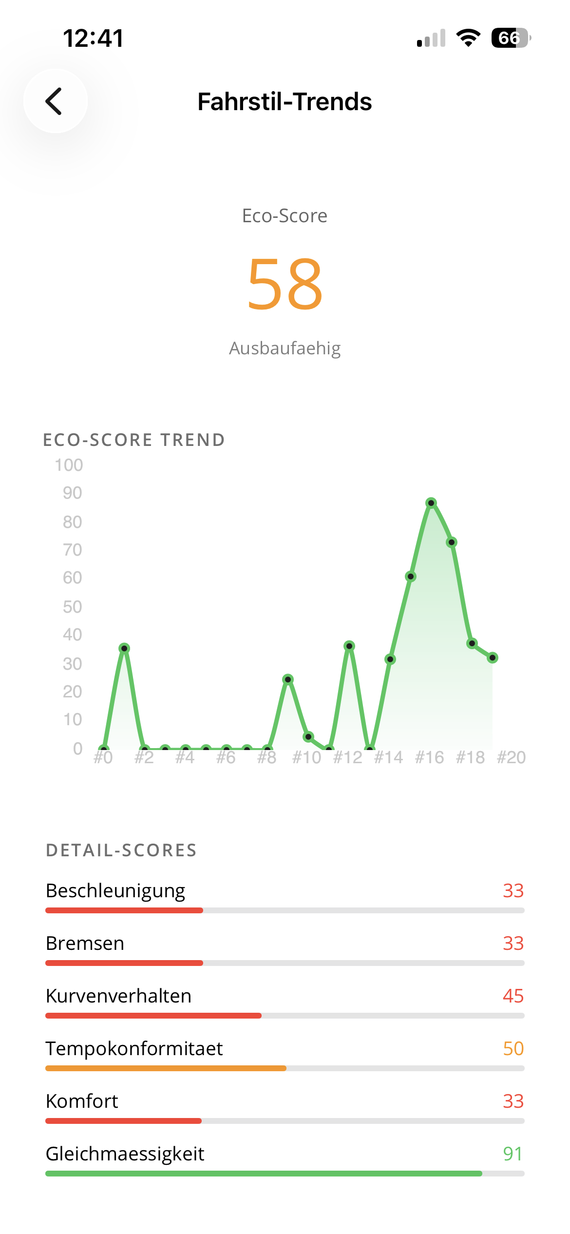
Driving Analysis & Machine Learning
Routes are scored across eco driving, braking, cornering, speed compliance, comfort, road quality and anomalies. A local AI evaluates each completed drive and turns the numbers into trip reports without sending driving data away.
IoT Sensors
Both vehicles report temperature, humidity, doors, windows, tilt, energy and device state. The clients buffer locally and sync automatically whenever connectivity returns.
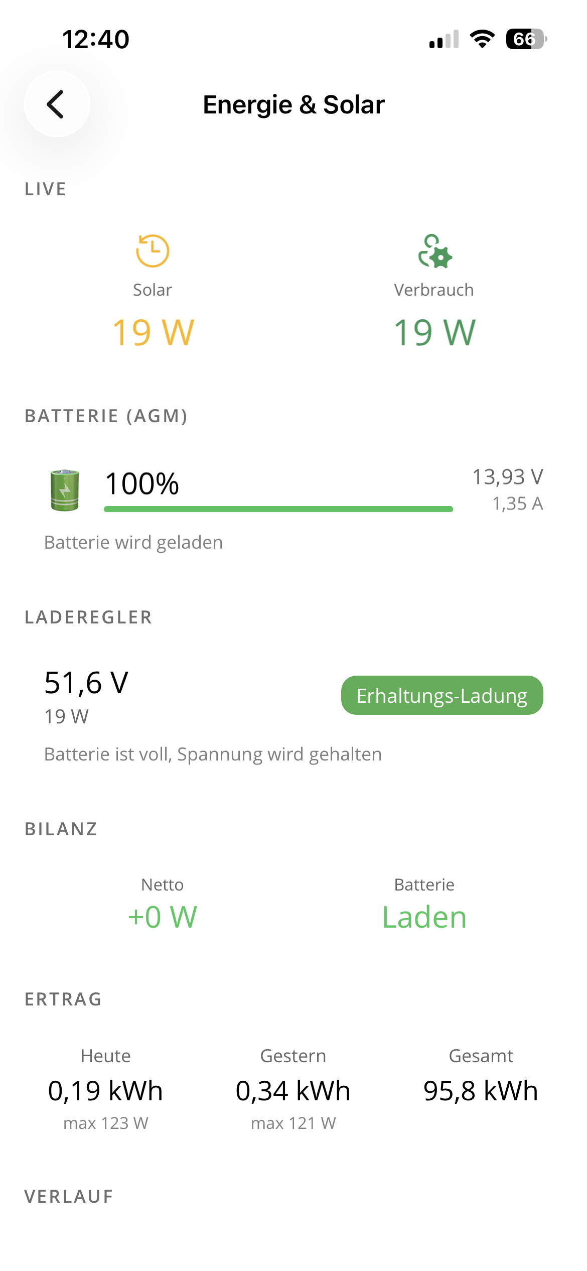
Energy Balance
Victron data shows solar production, battery state, daily yield and consumption. The app makes it clear whether the setup is charging, stable or needs saving.
Vehicle Status via VW Connect
The VW California's condition is regularly pulled via the VW Connect API — fuel level, mileage, maintenance intervals, door lock status and more. We have the vehicle status at our fingertips at all times, without being at the car or opening the VW app.
Motion Sensor (IMU)
A 9-axis motion sensor (acceleration, gyroscope, orientation) in the vehicle measures vibrations, road quality and driving comfort. The variance of the IMU data feeds directly into the route analysis — poor road surfaces, harsh braking and erratic steering are detected automatically.
Connectivity
Vehicle WiFi, 5G and Starlink work as one roaming network. The system picks the best uplink automatically and syncs buffered sensor data in the background.
BLE Diagnostics
Encrypted BLE broadcasts expose key diagnostic status nearby, even without WiFi, cellular data or Starlink. A fallback channel for remote places and dead zones.
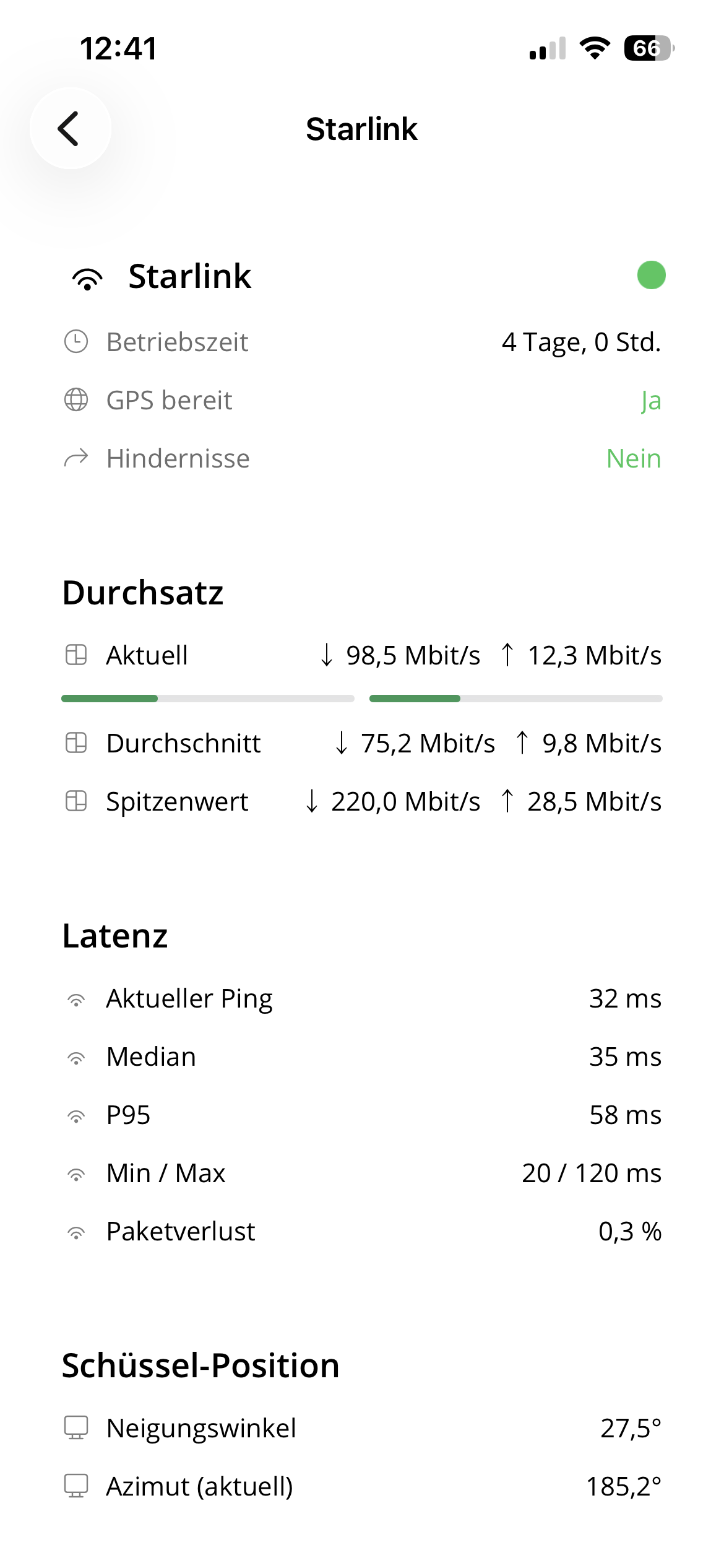
Starlink Telemetry
The Starlink dish delivers detailed telemetry via gRPC: throughput (current, average, peak), latency (ping, median, P95), obstructions, dish alignment (tilt, azimuth, elevation) and system status (heating, throttling, firmware updates). Everything is stored and visualized live in the app.
Smart Home & Alarm System
Shelly actuators control devices in both vehicles. The Weinsberg features an alarm system — unauthorized access triggers an immediate push notification. A dedicated media player system with Spotify integration and Bluetooth audio is built in — all controllable via the app.
Push Notifications
A custom push server delivers real-time notifications to iOS and Android — whether it's an alarm in the caravan, open windows when leaving, low battery voltage or a completed route analysis. No Firebase, no external services.
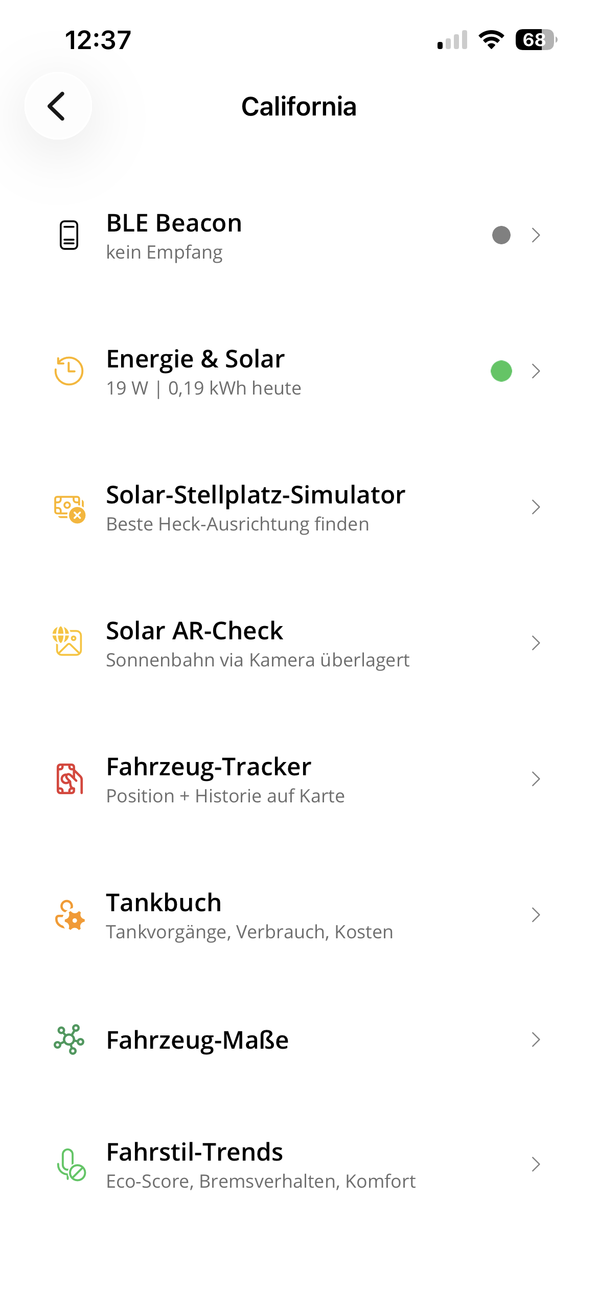
The App
Our app for iOS, Android and macOS is the control surface for the whole system: routes, live sensors, solar, travel journal, leveling, notifications and offline data. The app interface is currently German-only.
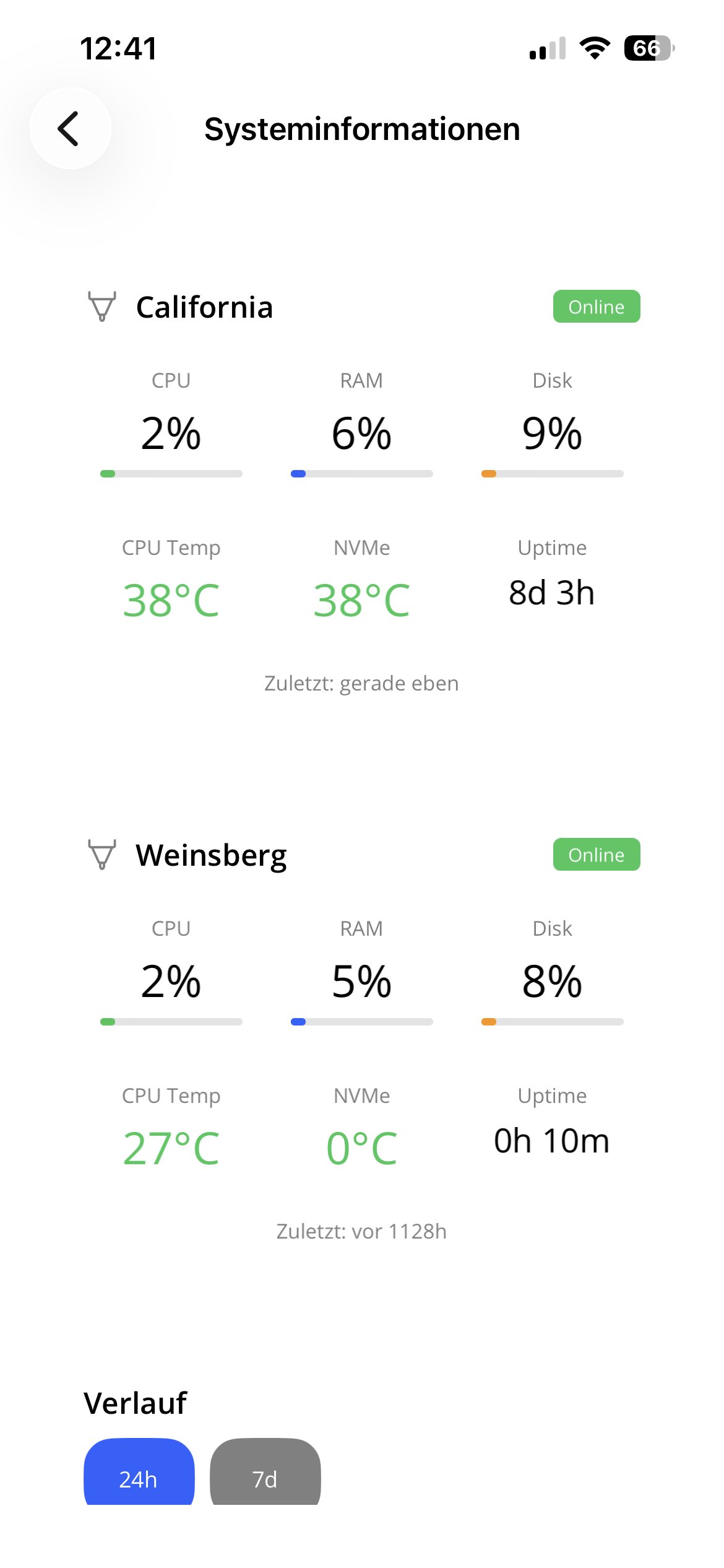
Monitoring & Log Analysis
All systems report health and logs centrally. CPU load, RAM, temperature, disk space and network status of the on-board computers are monitored, so errors and anomalies are visible before they become trip problems.
OTA Updates
All on-board clients can be updated remotely — at the push of a button, as soon as the code is changed and tests have passed. No need to physically access the computers in the vehicles.
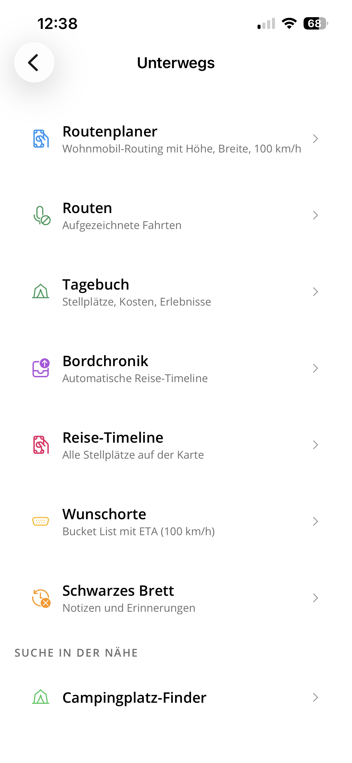
App Feature Map
The app is more than telemetry. It bundles travel planning, vehicle operations and everyday campsite tools into one private German-only interface.
Privacy
Privacy matters to us. No live location is ever shared publicly. Travel data such as kilometers, duration and countries visited is only published on this site once the system detects that we have arrived back home. While on the road, all data remains private.
Travel Statistics
This website displays our collected travel data: total kilometers, countries visited, overnight stays and campsites — automatically calculated and updated after every return home. Each pin on the map tells a story.
Backend Server
The central server processes incoming sensor data from both vehicles through a multi-step workflow engine. Uploads are extracted, checked, enriched with location and weather, turned into routes and then evaluated by local models. The private dashboard shows workflow state, upload history, sensor freshness, system health and connected devices.
Infrastructure
All mobile clients send data through a small public gateway, which forwards authenticated traffic to the home server without exposing it directly. The system runs self-hosted: database, time-series data, cache, logs, workflows and containers. Maps are self-hosted too, including tiles, routing, geocoding and our own satellite imagery.